loulé btt e, santa margarida, 29 km
06/05/2010 15:15
full screen, open track in gpsies
BTT E Santa Margarida
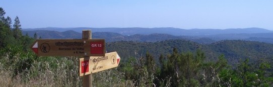
Mountain bike circuit E from the council of Loulé goes from the village of Santa Margarida, near Alte. The main road crossings is also the village's square and a good point to start this bike ride. The first part goes slowly up hill on tarmaced road. About 50% of this route is on tarmaced surface. The road offers excellent views of the valley deep down and the vast Serra do Caldeirão north of us. After passing the wind turbines at the end of the hill range there's a fast tarmaced descent and eventually we go off road to turn around the windmills and enter the valley on the other side of the hill range. It's a beautiful serene valley with comfortable dirt roads, small and quiet tarmaced roads and an occasional hiil to climb. All is well until we reach Macheira. We will do a loop from here before returning to Santa Margarida. The climb out of the village is not very long and starts pleasant. However having left the last houses behind us the pretty little dirt road gets steeper, the surface softer and on the last bit even the triple is not enough to put us on top of the hill range. Compensated by a spectacular descent and shaded by huge cork oaks we roll into Sarnadas. Turning south we have the massive limestone rock called Rocha de Soidos right in front of us. The indication on the road side shows us where we have the possibility to go all the way up. The first part on tarmac is fairly steep. Just below the top there's a dirt road going down the other side of the rock but you can see the single track into the rocky field going up higher. At the first limestone walls it is best to leave the bike and continue for the last bit on foot. The impressive cliff top is at an altitude of 467 meters overlooking great parts of the Serra do Caldeirão until the Serra de Monchique. The path back to the bikes is easy to find and the down hill continues with a wonderful, rather technical off road descent to complete the loop back to Macheira. The last part of the route is mainly up hill and after a couple of surprising turns through the orange farms we arrive back at the Santa Margarida square and café.
Distance: 28,55 km.
Accumulated ascent: 635 m.
Our rating:
- Technical difficulty 3/5
- Physical difficulty: 3/5
- Scenery: 4/5
Points of interest:
- Barrocal, Natura 2000 PTCON0049, www.icnb.pt
- Cascades of Vigário near Alte's cemetery
- 13th century water mill in the Alte river, Moinho de Abóboda
- Alte's 13th century main church and 15th century chapel.
- The springs of Fonte Pequena and Fonte Grande in Alte
- Casa Memória d'Alte museum
- Classified site of Rocha da Pena
Food and drinks:
- Café Nascer do Sol, Santa Margarida
- Café Pôr do Sol, Santa Margarida
Track author: Prof. Arménio, www.cm-loule.pt
Tags:
———
Back