loulé btt l, parragil, 15 km
23/03/2010 17:55
full screen, open track in gpsies
BTT L Parragil
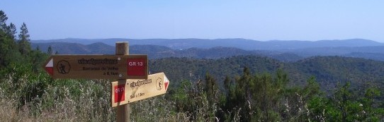
The mountain bike route at Parragil in the council of Loulé takes off from the village's main cross roads heading south west. At first slowly down hill on a tarmaced road. Soon we turn left to remain high on the hill side being offered new views on the coast and the Atlantic Ocean after every corner. We pass through the village of Soalheira and go around it towards Varjota. Only here we turn off road, in land and up hill. Not very high though. The descent on the other side of the hill top ends up a lot deeper than where we started climbing. Very pleasant, this usually feels the other way around. At good pace we get back to the main road at the Monte Seco junction. The second half of the circuit remains on the western side of this road. No more tarmac, great country tracks. After passing through the Boa Hora valley the easy part is definately done and we start climbing the dry rocky trails. A beautiful old connection track takes us along vegetable fields at the foot of Picota in direction of Alfontes. Long before we get there we have to negotiate some violent sections and suddenly take a sharp turn up to the left . This is where we start dealing with Picota itself. However after not too long the climb becomes more gentle and when we get as high as São Faustino we start cruising relaxed along Picota's northern slope overseeing the mighty Algibre valley. Finishing the circuit requires some attention. Be sure to break enough and stop in time before flying onto the Parragil crossroads.
Distance: 15,09 km.
Accumulated ascent: 358 m.
Our rating:
- Technical difficulty: 2/5
- Physical difficulty: 3/5
- Scenery: 3/5
Points of interest:
- Barrocal, Natura 2000 PTCON0049, www.icnb.pt
Track author: Prof. Arménio, www.cm-loule.pt
Tags:
———
Back